

Introduction to Houston Weather
Houston is expected to experience a chilly Monday morning with temperatures in the 50s. It is recommended to dress in layers to stay warm in the chilly air and slight breeze. However, it will start to feel a little warmer in the afternoon with highs in the mid-70s.
Pattern Change Begins
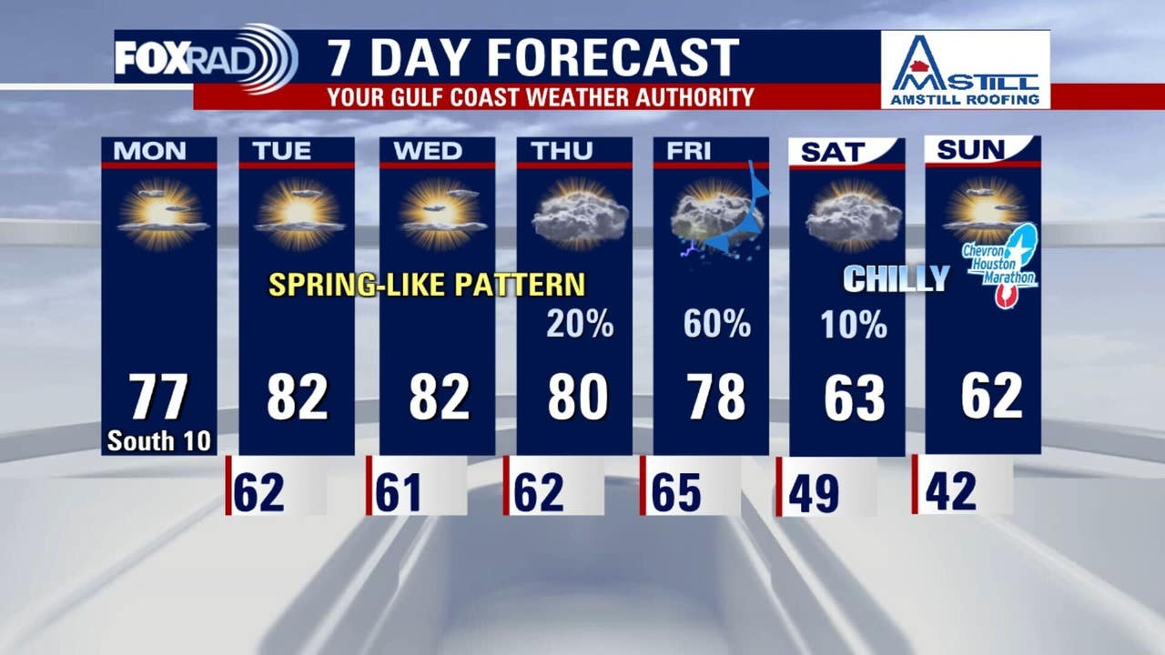
A chilly and foggy start to the work week will give way to a mostly sunny and mild Monday. As high pressure shifts eastward, southerly winds will return, pushing afternoon highs into the mid-70s. This begins a stretch of spring-like weather with humidity gradually on the rise over the next 48 hours.
Record Highs Ahead
The main story for the mid-week will be the record or near record warmth. Forecast models suggest temperatures could soar into the lower 80s by Tuesday and Wednesday, driven by sunshine and southwest breezes. Record highs are only 80 on Tuesday, 81 Wednesday, and 79 Thursday, so they are all in jeopardy. Morning lows will also be mild in the mid-60s.
Cold Front and Chilly Weather
By Friday, an approaching upper-level low and its associated cold front will finally break the warm spell. Increasing moisture from the Gulf will bring a good chance of showers and storms ahead of the front. Expect a breezy, rainy Friday followed by a return to more typical January temps with lows in the 40s and highs in the 60s. Plan for a chilly, but not frigid, start to the Chevron Houston Marathon on Sunday.
Conclusion
In conclusion, Houston’s weather will experience a significant change throughout the week. Starting with a chilly Monday morning, the city will see a rise in temperatures, potentially breaking record highs by Tuesday and Wednesday. However, a cold front will bring an end to the warm spell by Friday, followed by a return to typical January temperatures. It is essential to stay updated with the latest weather forecast to plan accordingly.